
I first stood on a sun-baked shore and felt the odd thrill of an ancient circle reappearing from water. That day I watched a ring of granite rise where the reservoir had once hidden it. Locals called it the dolmen guadalperal stonehenge, a name that captures both wonder and debate.
The monument had been found in 1926 and then lost under a 1963 reservoir project. Decades later, drought peeled the surface back and the stones returned to view, startling archaeologists and travelers alike.
I wrote this guide as a clear, first-person look at the spanish stonehenge. I cover its discovery, form, and the difficult choices around access and conservation.
My aim is to explain why this submerged site became a symbol around the world and why renewed public interest led to action to protect fragile heritage.
Key Takeaways
- I offer a firsthand overview of the monument’s rediscovery and history.
- The reservoir drowned the site in 1963 and droughts made it visible again.
- I explain archaeological features, alignments, and engravings later in the guide.
- The reappearance sparked global interest and conservation efforts.
- This guide balances travel curiosity with ethical care for fragile heritage.
Why I’m fascinated by Spain’s “Stonehenge” and what this guide covers
News that a long-submerged megalithic circle had resurfaced made me want to trace its journey through time and policy. The site’s reappearance in 2019 and again in 2022 pulled international attention and spurred fresh study.
I follow reliable reporting—Reuters, The New York Times, Smithsonian—and the 2022 designation by Spain’s Ministry of Culture that named the dolmen guadalperal a Site of Cultural Interest.
My interest grew as I tracked how modern infrastructure and policy shaped the monument’s fate. I wanted to understand what the stones can tell us and what remains debated.
- I organized this guide in clear parts: context, quick facts, architecture, history, resurfacing, meaning, protection, and how to visit responsibly.
- I weigh engravings and layout as evidence to consider burial or ceremonial uses across comparable sites.
- Across the years of coverage I highlight consistent concerns: erosion, looting risk, and the tug between access and protection.
Dolmen of Guadalperal at a glance: place, period, and purpose
I stood on a dry shoreline and traced a plan of stones that mark an ancient gathering place. The monument sits near Peraleda de la Mata in Extremadura, on a point by the Tagus River later flooded by the Valdecañas reservoir.
Archaeologist Hugo Obermaier recorded the site in 1926, anchoring its modern study. Most researchers place construction around 2000 3000 BCE, though some proposals push the date back as far as 5000 BCE.
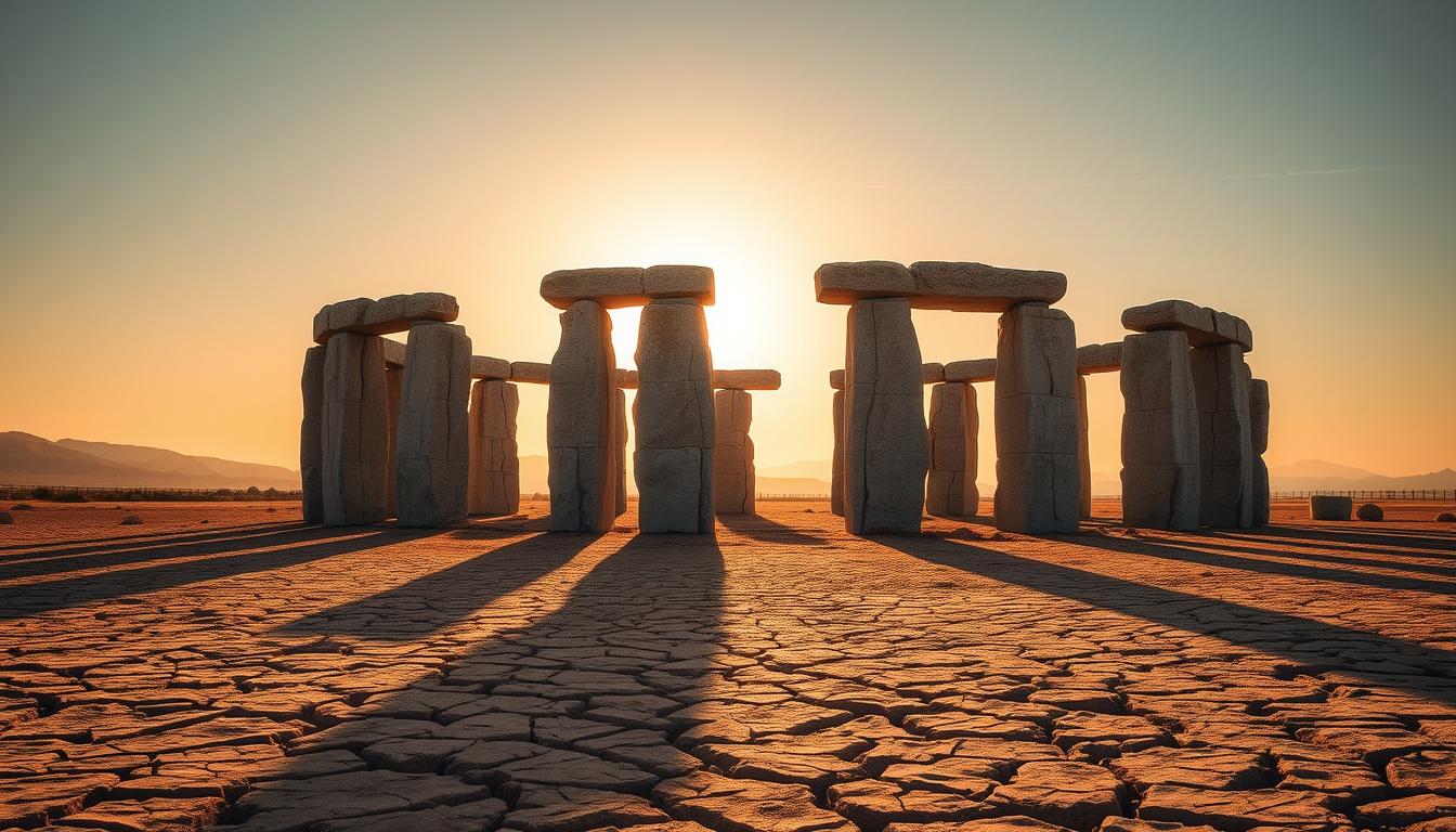
The structure included about 150 granite uprights forming an ovoid chamber roughly five meters across. A corridor of approximately 21 meters led to that chamber, shaping how people entered and moved within the site.
Proximity to a former river crossing on the Tagus suggests the place may have served trade, assembly, or ritual roles. I will return to competing interpretations later, but this overview gives scale and context for what resurfaced from the reservoir.
- Place: Peraleda de la Mata, Extremadura, by the Tagus River.
- Period: commonly 2000–3000 BCE, with older estimates to 5000 BCE.
- Structure: ~150 uprights; chamber ~5 meters; corridor ~21 meters.
Inside the monument: structure, stones, and engravings
I walked the approach and noted how the plan controlled movement. A corridor roughly 21 meters long funneled visitors into an ovoid chamber about five meters across. The effect is intimate: a broad path narrowing into a compact ritual space.
The layout relied on some 150 vertical uprights. These standing granite uprights—called orthostats or menhirs—outlined the corridor and chamber walls. Several stones rose above 1.8 meters, shaping sightlines and pacing inside the site.
Granite menhirs and material risks
The stones are permeable granite stones that softened under long submersion. Cracks, flaking, and fallen uprights record cycles of water, freeze, and warmth. That fragility complicates conservation and interpretation.
The carved entrance menhir
A single prominent entrance menhir bears cup marks, a snake-like line, and a human figure. Some scholars read the curving groove as a stylized Tagus River, linking the motif to landscape and memory.
| Feature | Measure / Detail | Interpretive note |
|---|---|---|
| Chamber | ~5 meters diameter | Compact communal or ritual space |
| Corridor | ~21 meters long | Channels movement and focus |
| Uprights | ~150, several >1.8 meters | Defines plan, creates sightlines |
| Entrance menhir | Carvings: cup marks, snake, human | Possible river depiction and anthropic sign |
- Orthostat refers to slab-like standing stones used to form walls or enclosures.
- Stone distribution and height likely structured ritual flow and visual emphasis.
- Engravings offer clues but remain open to multiple readings.
From discovery to submersion: Obermaier’s 1926 find and Franco’s reservoir
In 1926 Hugo Obermaier cataloged the circle, creating a baseline record before modern engineering altered the landscape. His drawings and notes became vital for later comparison.
I trace how the Valdecañas reservoir changed the place. In 1963 a dam project, part of mid-century development under Franco, flooded the valley.
For decades the site lay submerged. For many years only the stone tops broke the surface during dry spells.
“The reservoir turned living villages and ancient ground into a new waterline, reshaping both memory and access.”
Prolonged submersion altered preservation. Water, freeze cycles, and pressure sped deterioration and made fieldwork sporadic.
| Event | Year | Impact |
|---|---|---|
| Documentation by Obermaier | 1926 | Baseline for comparison after flooding |
| Valdecañas dam completed | 1963 | Area inundated; villages and landscape changed |
| Intermittent visibility | Mid-1960s–2019 | Only tips of uprights visible; research limited |
That arc—find, flood, long years underwater, then resurfacing—framed later conservation choices. Early records proved crucial when stones re-emerged after severe drought.
When drought lifts the waters: 2019-2022 reappearances and what I saw reported
In the dry summer of 2019 I watched a near-empty reservoir reveal a full circle of ancient uprights. That year’s exceptional drought—one of the worst in about 500 years—dropped Valdecañas to roughly 27–28% capacity and exposed the stones in a single, startling view.
The moment went global after a NASA satellite image and wide media coverage amplified the scene. Interest surged from researchers and travelers alike, and the site reappeared again in 2022 as drought conditions persisted.
What resurfacing revealed
When the water fell, I read reports describing cracked granite, several fallen uprights, and clearer engravings that were hidden for decades. The exposed corridor and chamber layout were easier to map on the dry ground.
“The sudden visibility offered a rare chance to document and to assess damage, but it also heightened risks from visitors and looters.”
- 2019: Reservoir drop exposed full plan; NASA image raised global awareness.
- 2022: Reappearance confirmed ongoing climate pressure and allowed fresh recording.
- Condition: cracked granite, fallen stones, exposed engravings; authorities increased protections.
| Aspect | Observed in 2019–2022 | Consequence |
|---|---|---|
| Visibility | Full plan visible twice in recent years | Better documentation opportunities |
| Stone condition | Cracks, flaking, toppled uprights | Immediate conservation needed |
| Human risks | Tampering and artifact removal reported | Heightened surveillance and restrictions |
dolmen guadalperal stonehenge: names, myths, and meanings
Locals long called the site “The Treasure,” a name that captured pride and kept stories alive while the water hid the circle for decades.
I note how popular names shaped public interest and how scholars weighed different readings of the place. Below I outline local identity, global nicknames, and the main interpretations of the monument’s purpose.
Also called “The Treasure”: local identity and global interest
The affectionate local name underlined community ties to the exposed ring of stones.
Elsewhere the site earned the moniker spanish stonehenge, which helped the story travel across the world and draw attention from researchers and tourists.
“The nickname helped mobilize protection but also simplified a complex past.”
Burial enclave, solar temple, or both? Interpreting the site’s role
Scholars propose multiple functions. One reading sees a burial enclave, informed by human remains at comparable Iberian sites.
Others read the plan as a solar or ceremonial space, shaped to focus movement and light. The carved entrance menhir—with a snake motif, cup marks, and a human figure—feeds river and ritual theories.
I believe layered use is plausible: trade and social gathering near a Tagus crossing could have coexisted with ritual practices over centuries dated roughly to 2000–3000 BCE, with some scholars suggesting earlier origins.
| Aspect | Evidence | Implication |
|---|---|---|
| Local name | “The Treasure” used by residents | Strong community identity and pride |
| Comparative finds | Human remains at nearby megalithic structures | Supports burial interpretation |
| Entr. menhir engravings | Snake, cup marks, human figure | Links landscape imagery to ritual meaning |
- Structures and motifs matter: form, placement, and art guide interpretation.
- Multiple hypotheses can coexist; the site likely changed roles across generations.
Protecting a fragile past: cultural status, conservation, and relocation debates
After drought revealed the circle, conservation teams had to balance quick action with careful study. In 2022 Spain’s Council of Ministers declared the site a Site of Cultural Interest, a legal term that unlocked protections and funding.
Declared a Site of Cultural Interest
The designation strengthened enforcement and created a framework for long-term stewardship. It also gave authorities tools to deter looting and regulate visits.
Archaeological safeguards
I saw reports that teams documented the plan, removed vulnerable artifacts for safekeeping, and assessed how permeable granite uprights had cracked after decades underwater.
Tourism pressures and ethical visitation
Rising visitor interest during low-water periods created risks. Experts debated relocating the structure to protect it versus keeping it in its original landscape.
“Decisions must weigh scientific study, public education, and the physical security of standing elements.”
| Action | Purpose | Result |
|---|---|---|
| Legal designation | Protect heritage | Funding, patrols, access rules |
| Artifact removal | Reduce theft, preserve finds | Museum custody, study |
| Stabilization | Prevent collapse | Monitoring, targeted conservation |
| Relocation debate | Reduce erosion & tourist impact | Ongoing stakeholder review |
- Keep distance, follow guidance, and support conservation-led visits.
- I recommend respecting barriers and reporting damage to authorities.
How I’d plan a responsible visit when conditions allow
Before I set out, I checked recent reservoir maps and local advisories to avoid surprises. That first call or website check tells me whether the shore is open and if patrols or barriers are in place.
I monitor the Valdecañas reservoir level and local rainfall. The stones only appear when waters fall enough. Drought seasons have shown the site twice in recent years, but conditions change fast.
Practical steps I follow
- Confirm access: I contact the tourism office or cultural authority to learn rules and opening times.
- Mind the shoreline: The place lies on the Tagus River’s impounded edge, so footing can be uneven and restricted for safety and protection.
- Respect barriers: I stay behind ropes, avoid the entrance corridor and chamber footprint, and never climb on uprights.
- Use a guide: When possible I visit with a trained guide to learn while supporting conservation.
- Photograph ethically: I keep distance and avoid shots that encourage others to breach protection zones.
- Leave no trace: I carry out trash, never collect artifacts, and report damage or tampering to authorities.
I prefer museums or visitor centers when the reservoir hides the site. They provide interpretation and reduce pressure on the fragile stones.
| What I check | Why it matters | What I do |
|---|---|---|
| Reservoir level | Controls visibility of the site | Call authority; delay visit if waters are high |
| Local restrictions | Protects fragile features and visitors | Follow posted rules; respect barriers |
| Footing & safety | Shoreline can be slippery or blocked | Wear sturdy shoes; avoid solo hikes |

Conclusion
I left the site with a clear sense that ancient design had survived centuries yet needed urgent care. The dolmen guadalperal — a field of roughly 150 granite stones and a carved menhir marking a meters-long corridor and compact chamber — links us to builders around 2000 3000 BCE.
The recent drought exposures in 2019 and 2022 revealed engravings, cracked granite, and fallen uprights after decades underwater. Spain’s 2022 designation as a Site of Cultural Interest began urgent conservation choices, including artifact removal and stabilization.
I hope this spanish stonehenge serves as a prompt: study and public interest must pair with strict protection so this fragile, standing monument can teach future generations about possible burial and ceremonial uses.
Lascia un commento