
I still remember the first time I drove a winding coast road and found a quiet cove where the day slowed down. I set out to reveal the canary islands hidden beaches I actually escape to today, places that feel private and real.
My aim is simple: point you to coves with raw scenery, calm water, or dramatic cliffs so you can pick the right island and beach for your style.

I’ll orient you to the archipelago’s landscapes so you know where rugged west-coast swell meets calmer eastern shores. I share practical tips from my trips — how I reach each spot, what I pack, and when a longer walk pays off.
These places reward patience. You’ll learn when water is rough, when cliffs block wind, and how to choose between a short hike or a car ride. The goal is a day that feels like a small adventure, with nature and safety first.
Key Takeaways
- Find quiet coves that match your pace and interests.
- Learn which island coasts offer cliffs, sand, or calm water.
- Use timing and light to maximize solitude and views.
- Pack simply and prioritize safety for nature-forward spots.
- Choose access by car or walk based on your comfort level.
Why I Seek Out Hidden Beaches in the Canaries Right Now
I chase out-of-the-way sands when I need a day that feels more like presence than a checklist. On the canary islands, those quiet coves give me space to breathe and a simple, sensory experience.
The appeal of untouched sand, dramatic cliffs, and quiet water
Untouched sand framed by dramatic cliffs and volcanic landscape slows my pace. The mountain backdrops and raw textures make each beach feel new, not staged.
I favor spots where nature leads and amenities stay minimal. Fewer visitors mean uninterrupted views, the hush of the water, and real beauty that rewards effort.
- Tips: arrive early, check winds and swell, and pack water and shade.
- Match the beach to the day’s conditions rather than chasing a name.
- Leave no trace and keep your presence light to protect the landscape.
Lanzarote’s Secret Shorelines I Keep Returning To
Lanzarote’s coast offers a mix of sheltered coves and wild headlands I return to again and again.
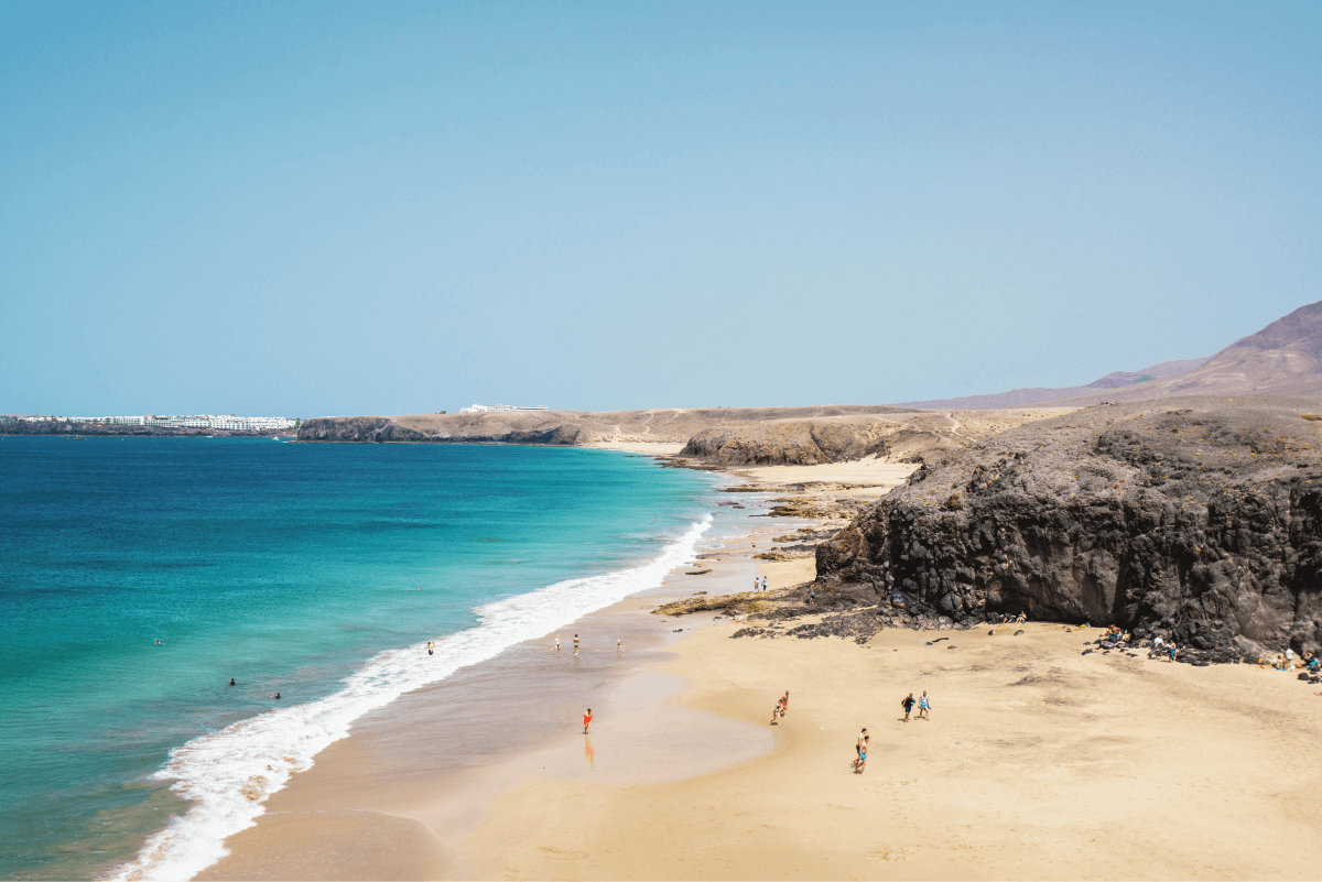
Papagayo sits inside the protected Monumento Natural de Los Ajaches. You drive a signed dirt track, pay the €3 entry, and park before a roughly 15‑minute walk to five small coves. Cliffs frame soft sand and create sheltered pockets with calm waters at the right tides.
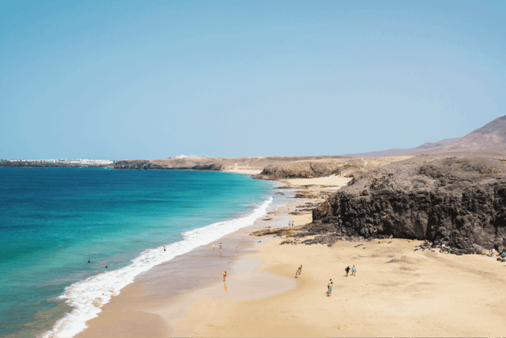
I treat these spots as a full day plan: bring shade, plenty of water, sunscreen, and easy snacks. Kiosks are minimal, so a simple day kit keeps me from having to leave once I settle in.
Famara: wind, surf, and wide sands
Famara runs about 4 km beneath the Famara mountains. It’s very windy, better for long walks and watching surfers than for settled picnics. If I want action, I book a beginner lesson; if I want rest, I eat at a seaside restaurant in the village.
| Feature | Papagayo | Famara |
|---|---|---|
| Access | Dirt track, €3 entry, 15‑min walk from car park | Main road to village; long beach access points |
| Vibe | Sheltered coves, calm pockets, soft sand | Open, windy, dramatic mountain backdrop |
| Amenities | Minimal kiosks; pack water and shade | Restaurants in village; surf schools nearby |
Fuerteventura’s Hidden Gems Most Visitors Miss
I go to Fuerteventura’s west coast when I want raw coastline where locals outnumber crowds and the day leans toward adventure.
Tebeto Beach
Tebeto lies off a dirt road from Tindaya at the mouth of a ravine. Small coves sit on both sides and the swell can be strong, so I treat the waters with respect. The spot is nudism‑friendly and rugged; bring sturdy shoes and plenty of water.
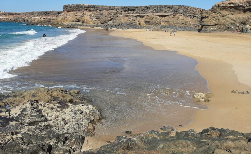
Jarugo Beach
Jarugo is a broad bay between high cliffs reached from the same Tindaya track. Fine brown sand meets seasonally heavy waves. I often stay on the shore when winds pick up and photograph the cliffs instead of swimming.
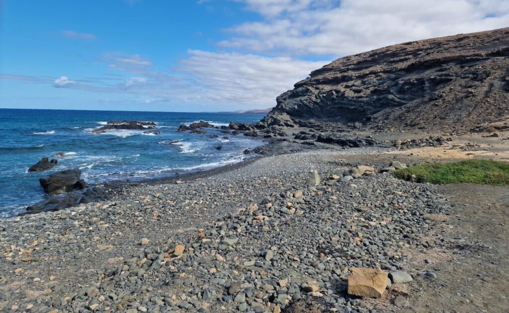
Playa del Junquillo, La Solapa, and Garcey
Playa del Junquillo’s volcanic sand is used locally for skin relief and a short path leads to ponds like Calets Mansos. La Solapa (La Lapa) shows golden‑and‑black sand and powerful west‑coast waves. Nearby Garcey offers eerie views toward the American Star wreck.
- I link several spots in one route to avoid backtracking on dirt roads.
- I pack simple gear, check winds and swell, and set a clear turnaround time.
canary islands hidden beaches: How I Get There by Car and Boat
Getting to quiet shorelines often means choosing between a bumpy dirt track and a calm sea transfer. I plan so I can reach remote spots without surprise delays.
Renting a car at Arrecife and navigating dirt roads safely
I usually rent a car at Arrecife Airport; booths from several companies make pickup quick and the value is solid. A small rental gives me the freedom to chase coves on my own timeline.
Drive tips: slow on washboard sections, keep tires on firm ground, and avoid soft shoulders. For Papagayo expect a €3 entry, a dirt track, and a 15-minute walk from the car park.
Reading local signage to reach Camino del Junquillo and other tracks
I follow signs to Aguas Verdes and then the Camino del Junquillo to reach Playa del Junquillo. For Tebeto and Jarugo, I take the dirt road from Tindaya. La Solapa and Garcey sit off FV-617 toward La Pared/Costa Calma via the La Solapa–Garcey turnoff.
When a boat or coastal path makes more sense
When access looks awkward or parking is tight, I consider a small boat transfer or a coastal walk. A short charter can show bays from the water and save time on a tight trip.
| Mode | Best for | Notes |
|---|---|---|
| Car | Flexible routing, multiple spots in a day | Rent at Arrecife; expect dirt tracks and small fees |
| Boat | Remote coves with poor road access | Choose calm conditions; book local charters |
| Coastal walk | Scenic access, quieter arrival | Pin trailheads offline; bring water and shade |
- Download offline maps and pin turnoffs before you visit.
- Carry cash for small entry fees and a basic day kit.
- Start early and give yourself extra time for photo stops and short hikes.
Winds, Waves, and When to Swim: My Safety Playbook
Before I step onto any sand, I read the sea like a map—winds, sets, and safe exits. I treat safety as part of the trip, not an afterthought.
Why Famara is for surfing and strolling, not picnics
Famara runs about 4 km beneath the Famara mountains and is typically very windy. That makes it perfect for long walks and surf lessons, not relaxed picnics near the water.
Several beginner surf schools operate nearby. If I want to try, I book a lesson and follow the instructor on currents and entry points.
Atlantic swell on Fuerteventura’s west coast: caution first
On Fuerteventura’s west coast, spots like Tebeto, Jarugo, and La Solapa often carry strong Atlantic swell. I assume power until proven otherwise.
“I assess the sea before committing—checking wave period, sets, and rip channels.”
- I treat Famara as a walking-and-watching beach: surf or stroll, not a picnic place.
- I assess the waters first and avoid swimming when sets look unruly.
- Cliffs can shelter some coves, but I still watch for shifting tides and rising surf.
- I bring extra water, sun coverage, and a windbreaker to stay warm and make clear decisions.
The goal: one safe, memorable experience each day. Respect the elements, choose the right beach for conditions, and enjoy the coast without close calls.
Pro Tips to Maximize Your Day on These Beaches
I time my days so the light and tide work together, not against me. A little planning turns a long drive into a relaxed, memorable visit.
Timing, tides, and light for the best views and photos
I aim for sunrise when sands are empty and tones are soft. Late afternoon gives golden angles that bring cliffs and textures alive.
Before I go, I check tide tables so I can reach coves, tidal pools, and reflective wet sand without getting cut off.
For photos I look for leading lines: tide marks, cliff shadows, and paths that draw the eye to the views.

Respecting nature and local etiquette on virgin beaches
I pack minimal gear — hat, sun shirt, water, snacks, and a lightweight towel — so I can move between spots quickly.
I follow a strict leave-no-trace rule: carry out trash, avoid trampling plants, and keep voices low to preserve the nature and calm.
I skip glass, use reef-safe sunscreen, anchor shade securely in wind, and treat drone rules with respect.
- Split the day: one anchor beach for relaxing, one short hike for fresh views, and one spontaneous stop if conditions look perfect.
- Talk to locals: they know the best parking, fragile paths, and safer water entries.
- Assume no services: treat virgin beaches as self-sufficient trips to avoid surprises.
Conclusion
When I map a day trip, I aim to pair one relaxed shore with one scenic drive to get the full coastline feel. That simple plan turns travel time into part of the visit and helps me find calm sand and good light.
Use Gran Canaria as a flexible add-on: it offers varied coastlines, reliable seaside cafés, and easy water sports options when you want them. Pack light, hydrate, and pick the right beach for wind and tide so your day stays relaxed.
I hope this guide gives you the confidence to seek out hidden beaches across the canary islands and enjoy the beauty, safety, and small adventures that come with exploring quieter spots. Keep a short list of Playa del favorites, listen to locals, and consider a morning boat charter if road access looks tough.
FAQ
What makes these remote shorelines worth visiting?
I look for untouched sand, dramatic cliffs, and quieter waters that contrast with crowded resort beaches. The views, rock formations, and chance to spot marine life or a weathered wreck add value to a day trip. I also enjoy the slower pace and local flavor found near small fishing coves and mountain-backed bays.
How do I reach Papagayo’s five coves and other secluded coves in Lanzarote?
I rent a car in Arrecife and follow the paved road to the Monumento Natural de Los Ajaches, then continue on the final dirt track to the official car park. From there I walk the signed paths to each cove. I avoid driving on protected dunes and use proper footwear for the rocky stretches.
Are there kiosks and facilities at these remote spots?
I usually pack shade, plenty of water, snacks, and a small first-aid kit because kiosks are scarce or seasonal. Some popular coves offer basic amenities, but many quiet bays have none, so I plan ahead for sun protection and waste packing.
Is Famara suitable for beginners who want to surf?
Yes. I find Famara ideal for beginner-friendly surfing schools along its broad beach, especially in calmer months. However, I treat it as a wind and waves spot — I avoid swimming far out on high-wind days and follow instructors’ guidance for surf conditions.
How do I get to Tebeto and Jarugo on Fuerteventura safely?
I drive toward Tindaya and use marked rural roads; some end in short hikes down ravines to the sand. For Jarugo I park where the paved road ends and walk along the cliff path into the bay. I check local weather and tide info before setting out, and I avoid narrow dirt tracks after heavy rain.
What hazards should I watch for on the west coast with strong Atlantic swell?
I respect strong currents and unpredictable surf. I swim only in lifeguarded areas or when local conditions are calm, and I never turn my back on the sea. I also watch for submerged rocks and sudden drop-offs near cliffs and keep a safe distance from breaking waves.
When is the best time of day to visit these spots for photography and light?
I aim for early morning or late afternoon for softer light and fewer visitors. Golden hour brings dramatic color to lava rock and sand contrasts, and low tide often reveals rock pools and tidal inlets that make better compositions.
Should I consider taking a boat instead of driving for some coves?
Absolutely. I take a short boat trip when road access is limited or the coastal path is long. Boats let me reach isolated bays, view cliffs from the sea, and access snorkeling spots with clearer water. I choose licensed operators and check fuel and safety gear beforehand.
How do I respect local rules and protect fragile landscapes when visiting?
I stay on marked paths, avoid trampling dune vegetation, and carry out all my trash. I follow local signage, avoid lighting fires, and use reef-safe sunscreen. I also support nearby villages by buying food or services from local vendors when possible.
Are there places with volcanic sand and unusual pools to explore?
Yes. I’ve found volcanic-black sand beaches and quiet ponds accessed via hiking trails, such as paths near Playa del Junquillo. These spots offer striking contrasts between dark sand, blue water, and rugged mountain backdrops—perfect for short hikes and nature observation.
Can I combine a visit to these beaches with other island activities?
I often pair beach time with short coastal hikes, local village lunches, or watersports like snorkeling and beginner kitesurfing where conditions allow. This mix gives me both adventure and relaxation in a single day trip.
Lascia un commento