I visited Ronda to trace how a single cliffside complex blends myth, recorded history, and vivid design. At the very edge of the Tajo, this site holds a late medieval Water Mine, an 18th-century house remodeled in neo-Mudéjar style, and a formal garden by Jean Nicolas Forestier.
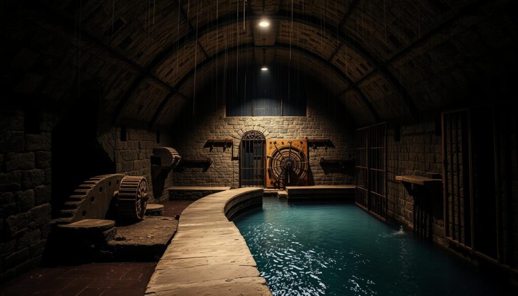
The Water Mine gave townspeople secure access to the river during sieges. In 1485 control of its waterwheel proved decisive when attackers cut the town’s supply and forced surrender. That episode ties the popular name to real strategic infrastructure.
Forestier’s 1912 layout blends Hispano-Muslim motifs with early 20th-century geometric style, creating layered views between terraces, fountains, and planted rooms. Today the mine and gardens welcome visitors while the house remains under restoration.
Key Takeaways
- I combine local lore, archival history, and on-site observation in this guide.
- The complex has three key parts: Water Mine, historic house, and Forestier’s garden.
- Water systems shaped military outcomes and the city’s story in the 15th century.
- Forestier mixed Hispano-Muslim motifs with early modern geometric design.
- The mine and gardens are open now; the house is closed for restoration.
Why I’m Drawn to Ronda’s Most Enigmatic Site
I return because the place reads like a compact story on a cliff. A house and terraces sit literally on the edge, opposite the Almocábar Gate and the old Alcázar, with unmatched views over the Guadalevín and the historic city.
The Water Mine opened to visitors in 1990 and now features a river-level platform. From there I can look up at sheer walls and trace how water cuts through rock. That downward view changes how I read local history; defense and daily life feel immediate.
Forestier’s 1912 plan shapes three geometric terraces linked by rills and stairs. Those gardens make the steep ground legible and frame long sightlines between architecture and terrain. Each terrace and path gently prepares you for the mine descent.
I feel the aura tied to the moorish king name, but I also separate myth from evidence when I explore. Practical notes on how to visit, what footwear to choose, and how timing affects access will follow.
Legend of the Moorish King of Ronda: Myth, Memory, and the City on the Edge
Stone steps, hidden galleries, and a resonant dome turned a practical water route into a story-telling space. I trace how a frontier post became a place where architecture fed imagination.
Origins in frontier rule
In the mid-14th century, Marinid governor Abd al-Malik — known in local lore as king abomelic — ran Ronda while the nasrid kingdom guarded its western edge against the kingdom granada’s pressures. A coracha-style secret mine gave protected access to the Guadalevín and real strategic value.
Whispers in the Hall
The Hall of Secrets has a qubba-like dome that carries a whisper from one corner to another. Those acoustics and the close rooms made simple conversation sound like council. That quality helped rumors of intrigue and treasure stick to the site.
What records actually show
Christian chroniclers, notably Andrés Bernáldez, note that in 1485 troops seized the stairway and cut off water, forcing surrender. The tale kept growing, but the core is practical: control the water, control the city.
- Key point: water and access—not treasure—explain the site’s power.
Inside the Water Mine: Medieval Engineering, Defense, and Survival
A narrow chute carved into limestone holds one of the site’s most pragmatic wonders: a defended route down to the Guadalevín that joins supply and security in a single plan.
Dating and construction context
Scholars place this work in the 14th century, during Marinid administration on a tense frontier. Some sources point to Berber craftsmen from Ifran, while later chronicles note Christian captives working inside. That context explains why such bold engineering and construction were needed.
How the descent functioned
The passage drops in a tight vertical tunnel with roughly 231 steps. Side alcoves and small rooms open like guard posts. The plan is a monumental coracha: protected access to essential supply along the cliff.
Mechanics and human labour
A large Waterwheel once sat in a hall carved at river level. Narrow galleries ruled out animal traction, so human labour ran the device and kept water moving uphill. That intense work made the hall a vital, vulnerable core.
Siege logic and river access
Defensive features—arrow slits, arches, and controlled entry points—turned supply lines into a line of defence. In 1485 attackers seized the stair and disabled water extraction; cutting supply forced a swift surrender. At the base, a small door onto the river served both supply and last-resort escape.

- Key takeaway: the water mine blends practical water access with deliberate defence.
- The modern river platform helps me read how galleries meet the cliff and how design solved real threats.
The House and Gardens: From 18th-Century Residence to Forestier’s Hanging Landscape
A compact cliffside house grew over centuries into a theatrical ensemble of rooms, terraces, and watercourses. The core began as an 18th century residence that later absorbed adjacent parcels to form a single, dramatic building on the precipice.
Patronage and remodelling
In 1911 Trinidad von Scholtz Hermensdorff, the Duchess of Parcent, unified ownership and commissioned a neo-Mudéjar remodelling. Her work gave the house moorish a distinctive silhouette and linked interior spaces to new terraces.
Forestier’s garden plan
In 1912 Jean Nicolas Forestier, a french landscape architect, laid out three terraces. His french landscape vocabulary used geometry, rills, and a fountain that feeds a lower pond. The sequence—fountain to rill to pond—lets moving water carry sound and sight down the slope.
Designation and conservation
The ensemble earned a cultural interest status in 1943. A historic fountain has been restored, and today I can walk the gardens and descend to the mine. The main house remains closed while restoration work protects the building fabric for future visitors.
- Key point: Forestier’s 20th century plan marries Hispano-Muslim tradition with disciplined French style.
- Conservation preserves both construction detail and the overall landscape intent.
People and Periods That Shaped the Site
This cliffside complex reads as a timeline: frontier defence, a domestic expansion, then a 20th-century makeover.
King Abomelic and frontier stewardship
King Abomelic (Abd al-Malik) managed the town in the 14th century as Marinid stewards supported the nasrid kingdom frontier.
The mine’s design responds to city-level defence logic. Redundant access and guarded galleries reflect pressure along that western border.
From Salvatierra to the Duchess of Parcent
The house built over the mine began in the 18th century and later passed to the Marquisate of Salvatierra.
In 1911 Trinidad von scholtz Scholtz Hermensdorff, the duchess parcent, bought and reshaped the property. Her patronage launched the 20th century renewal and Forestier’s terraces.
| Era | Key actor | Date | Primary role | Legacy |
|---|---|---|---|---|
| Medieval | King Abomelic / Marinids | 14th century | Fortify water access | Defensive galleries |
| Early Modern | Marquisate of Salvatierra | 18th century | Domestic expansion | House built over mine |
| Modern | von scholtz / Duchess Parcent | 20th century | Design and restoration | Forestier gardens |
Why this timeline matters: reading these layers helps me tell what belongs to military need and what is later taste, so I can interpret each feature on site.
Plan Your Visit: What I Look For When I Go
My route always begins with a slow walk across Forestier’s terraces to set the scale before descending. Starting at the upper gardens gives a clear view of the edge and the rill-fed axes. That helps me read later moves through stairs and galleries.
What to see on site:
- I always pause in the Hall of Secrets to test the acoustics and imagine whispered councils.
- Then I descend the water mine and study the waterwheel setting to picture how water moved uphill.
- The river platform at the base gives a dramatic upward view of the cliff and carved galleries.
Practical details and safety
The site is open daily from 10:00 a.m. to 9:00 p.m., with last entry 30 minutes before closing.
Adult tickets cost €10; children under 12 pay €3. Buy tickets on site and plan to enter at least 45–60 minutes before last entry to avoid rushing.
Expect narrow passages, changing ceiling heights, and cooler, damp air below ground. I wear sturdy shoes and use handrails. A light layer helps with the cooler temperatures inside the mine.
Context on access and history
Access down to the Guadalevín is about a 60-meter descent. As you reach the lower levels, picture the 1485 conquest ronda moment when troops targeted the waterwheel to cut the city’s supply.
| Item | Detail | Why it matters |
|---|---|---|
| Hours | Daily 10:00–21:00 | Plan arrival 45–60 minutes before last entry |
| Tickets | Adult €10; Child €3 | Purchase on site; timed to allow full route |
| Descent | ~60 meters to river platform | Unique upward view; narrow access |
| House | Main house closed (restoration) | Focus on terraces, mine, and galleries |
Conclusion
Walking back up from the river, I feel how closely water, defence, and daily life bind this cliffside site.
I see a 14th century plan that used bold engineering to protect access. The water mine and its stair remain the clear through-line. In 1485 troops cut the water supply and changed the city’s fate.
The 18th century house built above the shaft later gained a new style in the 20th century when von scholtz hermensdorff commissioned nicolas forestier. That french landscape architect layered gardens over hard construction without hiding the work below.
Declared a cultural interest, the place shows how a moorish king name, patrons, and careful conservation keep engineering, garden design, and access in view. Take time to pause on each terrace and look up from the river side.


Lascia un commento